Kathmandu | August 28, 2026 | INFRAINTEL Bureau
(The Times Of India)
Earth scientists examining satellite imagery say a major bedrock failure beneath part of a glacier on Langtang Lirung appears to have triggered the destructive flood that swept through communities near the Nepal-Tibet border.
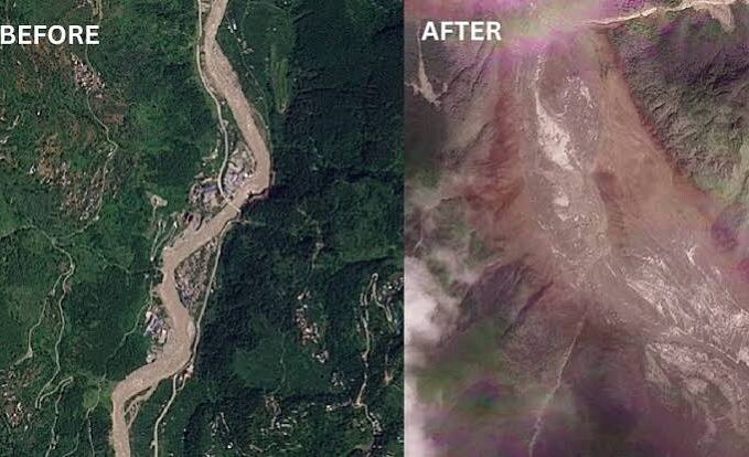
Initial images were obscured by cloud and debris, but clearer imagery indicated that a large section of mountainside collapsed with glacier ice, sending boulders and ice into a steep valley.
Researchers said the debris retained momentum as ice melted, producing a high-energy flow of water, mud and sediment. Before-and-after images show the Trishuli River widening and changing colour as it overtopped banks and carried large volumes of debris through Kolpurtar, Betrawati and Syapru Besi.
Scientists described villages and buildings buried by mud and debris and warned that recovery could take years. One researcher linked the instability to broader warming trends and weakening permafrost, while others said a direct climate-change attribution could not yet be made from the available evidence.
The event demonstrates the cascading nature of high-mountain hazards: rock failure can mobilise glacier ice, generate debris flows and amplify downstream flooding far from the initial collapse. Future risk reduction will require glacier and slope monitoring, satellite-based early warning, valley evacuation planning, resilient bridges and settlement-level hazard mapping across national boundaries.