Kathmandu/Manchester | September 4, 2026 | INFRAINTEL Bureau
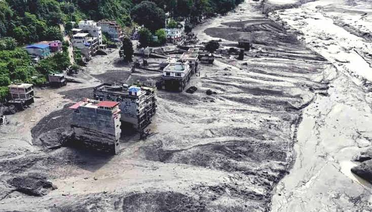
(NDTV)
The recent Nepal flood has exposed gaps in warning systems designed for conventional floods rather than sudden cascades involving rock, ice, debris and water across international borders.
Instruments detected a seismic signal near the Nepal-China border at 8.37 am; seven minutes later, surveillance footage recorded destruction at the Gyirong border post. Nepalese flood authorities learnt of the event around 9 am and issued an emergency text alert at approximately 9.15 am.
The initial signal resembled a small earthquake, while river gauges shifted rapidly from normal readings to destruction. Researchers argue that integrated analysis of seismic observations, satellite imagery, river monitoring and community reports might provide downstream communities with more usable time.
Nepal and China agreed in principle after a 2025 flood to share real-time information on floods, landslides and glacial lakes, but the source article says no formal agreement has been concluded. Existing water arrangements are not designed for fast-moving, multi-hazard events.
A regional system would require predefined data-sharing rules, permanent scientific and policy coordination, multilingual alerts, local volunteers and agreed response triggers. Technology can improve detection, but warnings save lives only when they travel rapidly from mountain sensors to exposed households and prompt understood action.